OS1/20/2/28


| List of names as written | Various modes of spelling | Authorities for spelling | Situation | Description remarks |
|---|---|---|---|---|
| POLWHAT RIG | Polwhat Rig | Thomas Stewart n & s Clennoch Carsphairn John Fergusson Glenlee N. [New] Cumnock |
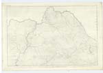
002 | A considerable long ridge or hill extending North West and South East Situated on the farm of Moor the Surface of which is rough pasture interspersed with a few Small rocks, on the North West end is a Trigl. [Trigonometrical Station] Called by Trigl. [Trigonometrical] Party Trostan, it forms a range which has not a name with Dugland etc. |
| FINGLAND BURN | Fingland Burn | Thomas Stewart n & s Clennoch Carsphairn John Fergusson Glenlee N. [New] Cumnock |
002 | A small Mountain Stream gathering on the farm of Moor and running in a N. [North] Westerly direction increasing much in Sized on its Course and joines the Water of Deugh Convenient to Finglandfoot how it obtain the name is not known. |
Continued entries/extra info
[Page] 28List of Names collected by John Bray C.A. [Civilian Assistant] 1st Examiner
Parish Carsphairn
Plan 2B Trace 4
Objects
Polwhat Rig - A hill
Fingland Burn - A Stream
[Signed] John Bray C/a [Civilian Assistant] Decr. [December ] 3rd 1849
Transcribers who have contributed to this page.
DANIALSAN
Location information for this page.
Linked mapsheets.