OS1/20/18/9


| List of names as written | Various modes of spelling | Authorities for spelling | Situation | Description remarks |
|---|---|---|---|---|
| BUSH | Bush Bush Bush Bush |
John Mitchell Robert McAdam Ainslies Map Valn. [Valuation] Roll. 1819 |
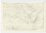
009 | [Situation] 5/8 Miles W.S.W. [West South West] of Forrest farm house. A farm house and out houses in middling repair with a large farm of land attached, Occupied by John McTurk The property of Sir William Miller of Glenlee, |
| BENNAN HILL | Bennan Bennan Bennan Hill |
John Mitchell Robert McAdam Plan 15 A |
009 | [Situation] About ¾ Miles W. by S. [West by South] of Forrest farm house. A small hill on the farm of Bush its surface consists of rocky heathy pasture, On its summit is a Trigl. [Triginometrical] Station called by Trigl. [Trigonometrical] Party "Buss" |
| BURNHEAD BRIDGE | Burnhead Bridge Burnhead Bridge |
John Mitchell Robert McAdam |
009 | [Situation] 10 chains S. [South] of Forrest farm house A small stone bridge of one arch crossing Burnhead Burn "hence the name" It is a County Bridge |
Continued entries/extra info
[Page] 9Parish of Kells
Form 136 Page
25 Bush
26 Bennan
26 Burnhead Bridge
Transcriber's notes
BARNHILL WOOD See page 11 for thisTranscribers who have contributed to this page.
DANIALSAN, Gerald Cummins
Location information for this page.
Linked mapsheets.