OS1/20/156/26


| List of names as written | Various modes of spelling | Authorities for spelling | Situation | Description remarks |
|---|---|---|---|---|
| TORR HILL | John Meyers John McKetterick See North Book 51B |
052 | A small hill on the farm of Torr, its surface is chiefly Rocky Pasture except its end side which is covered with wood, on its summit is a Trig Station Called by Trig Party "Torr Point" | |
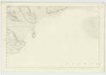
| TORR POINT | John Myers J. Carson Ainslie's Map 1820 Admiralty Chart |
052 | A headland on the farm of Torr, projecting for a considerable distance into the sea on the West side of Orchardton Bay around High Water Mark it is bounded by flat Rocks |
Transcribers who have contributed to this page.
haggis
Location information for this page.
Linked mapsheets.