OS1/20/154/11


| List of names as written | Various modes of spelling | Authorities for spelling | Situation | Description remarks |
|---|---|---|---|---|
| KILN HILL PLANTATION | Kiln Hill Plantation Kiln Hill Plantation |
James Doran Patrick Trayner |
051 | A small plantation of mixed wood on the farm of Gribtae [Gribdie] and estate of William Bell Esqr. Balgreddan |
| SYPLAND MOAT | Sypland Moat Sypland Moat Sypland Moat Sypland Moat |
Mr. Davidson Mr. Williamson Mr. Findlayson Robert Blacklock |
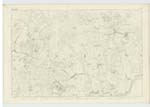
051 | A tolerable large fort on the summit of a considerable hill on the farm of Meikle Sypland. This fort measures at its base about 140 ft. [feet] and tapers a little towards the summit, which is about 120 ft. [feet] in diameter, it is elevated about 5 ft. [feet] and is surrounded on all sides except the east by a fosse, and rampart, which is still pretty entire. It is naturally defended on the E. [East] by an abrupt declivity, about 130 ft. [feet] deep. From its summit is a grand and comprehensive view of the surrounding country, the mountain ranges of Minnigaff Kells and Carsphairn. The Burrow Head, The Mull of Galloway. The Isle of Man. The Cumberland Hills. The Estuary of the Dee. A wide expanse of the Irish Sea, And on a favourable day, the mountains of Mourne in Ireland can be seen. This object is almost invariably call a "Moat", and by which term it is well known, altho'. [although] any intelligant person would at once call it a "Fort". on its western margin is a Trigl. [Trigonometrical] Station called by the Trigl. [Trigonometrical] party "Meikle Cyperland" |
Continued entries/extra info
[Page] 1112000, Oct. 1847 Parish of Kirkcudbright No. 21.
Form 136
Page
68
64
Transcribers who have contributed to this page.
DrewM
Location information for this page.
Linked mapsheets.