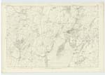
OS1/20/151/63


| List of names as written | Various modes of spelling | Authorities for spelling | Situation | Description remarks |
|---|---|---|---|---|
| MILL HOUSE | Mill House Mill House Mill House |
Charles Brackridge Alexander Reed Map of County |
050 | [Situation] About 1 3/8 Miles S.S.E [South South East] of the town of Kirkcudbright. A house in middling repair on the farm of Cannee, formerly a Mill had been adjacent (hence the name) No trace of the Mill is now to be Seen. - |
| LOW BANKS | Low Bank Low Bank Bank . Galtway Banks |
John Muir Adam Lee Val [Valuation] Roll (1819) Ainslie's Map 1820 |
050 | [Situation] About 1 1/2 Miles S.E. by S.[South East by South] of the town of Kirkcudbright. A farm house two Stories high and out houses (including a thrashing machine) all Slated and in good repair, with a farm of about 400 acres of land attached. the property of the Earl of Selkirk. |
| HIGH BANKS PLANTATION | High Banks Plantation High Banks Plantation |
Charles Brackridge . John Muir |
050 | [Situation] About 1 1/4 Miles E.S.E [East South East] of the town of Kirkcudbright. A considerable plantation on the farm of High Banks (hence the name) the wood of which consists of Oak, Ash, Beech Firs etc a little to the South is a Trigl. [Trigonometrical] Station called by Trigl. [Trigonometrical] Party "Highbank" |
Continued entries/extra info
[Page] 63Parish of Kirkcudbright
Transcribers who have contributed to this page.
Chr1smac -Moderator, Skinnb1- Moderator
Location information for this page.
Linked mapsheets.