OS1/20/151/52


| List of names as written | Various modes of spelling | Authorities for spelling | Situation | Description remarks |
|---|---|---|---|---|
| QUEEN OF SARDINIA ROCK | Queen of Sardinia Rock Queen of Sardinia Rock Queen of Sardinia's Rock Queen of Sardinia Rock Queen of Sardinia Rock Queen of Sardinia Rock |
Earl of Selkirk . William Mure Esqr. . Map of County . Ains [Ainslie's] Map 1820 Mr. J. Nicholson . J. Milligan |
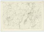
050 | [Situation] About 1 3/8 Miles S [South] of the town of Kirkcudbright. A large rock visible at high water, in Manxmans Lake and a little to the East of St Mary's Isle it took its name in consequence of a vessel being wrecked on it called Queen of Sardinia. |
| SAND SIDE | Sand Side Sand Side Sand Side Sandside |
Earl of Selkirk William Mure Esqr. Map of County Ainslies Map 1820 |
050 | [Situation] About 5/8 Mile S. by E. [South by East] of the town of Kirkcudbright. A few detatched houses on the West side of the road leading from Kirkcudbright to Dundrennan they derive their name from the near proximity to the Sands of Manxman's LaKe.- |
Continued entries/extra info
[Page] 52Form 136
Page 190- Queen of Sardinia Rock
Page 109 - Sand Side
Transcribers who have contributed to this page.
Chr1smac -Moderator, Skinnb1- Moderator
Location information for this page.
Linked mapsheets.