OS1/20/140/9


| List of names as written | Various modes of spelling | Authorities for spelling | Situation | Description remarks |
|---|---|---|---|---|
| MERSEHEAD SANDS | Mersehead Sands Mersehead Sands |
John Wilson John Atkin |
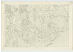
046 | [Situation] On the shore of the SW [South West] side of Kirkbean Ph [Parish] A large tract of Sands extending from the shore of the farm of Mersehead to low water this tract is interspersed with several remains of wrecked vessels, |
| BARNHOURIE | Barrhourie Barrhourie Barrhourie |
John Wilson John Heyslop Ainslies Map. No 20 |
046 | [Situation] At the SW. [South West] Side of Kirbean Parish. A large Sand bank Situated South Side off the Shore of Kirkbean parish. It is of an oblong shape extending in the direction of east and west about 4 miles in length and about 1 1/2 miles in breadth. It is very detrimental to the navigation of this part of the Solway there are the remains of a few vessels wrecked here to be seen at present It appears that the bank is liable to change as its position or extent is not now as it was a few years ago. |
Continued entries/extra info
[Page] 9Parish of Kirkbean
Transcribers who have contributed to this page.
Trondragirl- Moderator
Location information for this page.
Linked mapsheets.