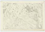
OS1/20/136/39
| List of names as written | Various modes of spelling | Authorities for spelling | Situation | Description remarks |
|---|---|---|---|---|
| BENTUTHER HILL | Bentuther Hill Bentuther |
[George Barber [Thomas Clark Ainslies Map of Kircudbright 1796 See Also Name List Plan 45C |
045 | [Situation] About 1/4 mile north of Dungarry Camp. - A considerable hill on the farm of Bentuther the surface of which is Rocky heathy pasture, it is the properly of the Earl of Selkirk It is part of a range. - |
| DUNGARRY | Dungarry Dungarry |
Thomas Clark John Cannon |
045 | [Situation] A little SW. [South West] of Bentuther Hll A tolerable size a hill on the farm of Bentuther consisting of Rocky heathy pasture The property of the Earl of Selkirk |
| DUNGARRY CAMP | Dungarry Camp Dungarry Camp Dungarry Moat Dungarry Camp Dungarry Camp |
John Cannon Thomas Clark Ainslies Map of Kirkcudbright 1796 Dr. Trotter William Thompson |
045 | About 2 3/8 miles SSW. of Dunguile Camp. - A small enclosure on the summit of Dungarry it has the appearance of a Camp. nothing can be learned of its origin either from History or the information of the inhabitants in the neighbourhood. |
Continued entries/extra info
page] 39Parish of Rerrick
---
page 106 - Bentuther Hill, Dungarry Camp; 105 - Dungarrry
Transcriber's notes
plan no. is not visible due to fold at spineTranscribers who have contributed to this page.
VickiColeman
Location information for this page.
Linked mapsheets.


