OS1/20/13/17


| List of names as written | Various modes of spelling | Authorities for spelling | Situation | Description remarks |
|---|---|---|---|---|
| AUCHRAE HILL | Auchrae Hill Auchrae Hill |
James Gilchrist William Clymont |
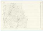
006 | A considerable hill on the farm Big Auchrae, its surface consists of rocky pasture. |
| AUCHRAE BURN | Auchrae Burn Auchrae Burn |
William Clymont James Gilchrist |
006 | A considerable stream or burn having its rise on the farms of Manwhill and Auchrae, and running in a S. [South] West direction to its conflux with the Water of Ken. |
| MANWHILL HILL | Manwhill Hill Manwhill Hill |
John Ramsay William Ramsay |
006 | A tolerably sized hill on the farm of Manwhill, its surface consists of Rocky pasture. On one Eminence (on its summit) called Dodd is a Trigl. [Trigonometrical] Station called by Trigl. [Trigonometrical] Party "Holme Whole". This hill is a prominent part of a small irregular range. |
Continued entries/extra info
[Page]17Parish of Dalry
Left hand side of page Form 136 Page 45 Auchrae Hill; 45 Auchrae Burn; 46 Manwhill Hill
Auchrae Hill
[Name] Auchrae appears to be from the
Gaelic Achad reidh. The level field or plain &c.
[Situation] About 1 3/4 NW. [North West] of Cornharrow farm house
Auchrae Burn
[Situation] Running in a SW [South West] direction to its influx with the Water of Ken. about 5/8 miles WSW [West South West] of Meikle Auchrae
Manwhill Hill
[Name] Moine a' Phuill. The bog or
moss of the pond or pit
[Situation] About 1 mile N.N. [North North] West of Cornharrow farm house.
Transcribers who have contributed to this page.
Gerald Cummins
Location information for this page.
Linked mapsheets.