OS1/20/127/21


| List of names as written | Various modes of spelling | Authorities for spelling | Situation | Description remarks |
|---|---|---|---|---|
| KIRKBRIDE HILL | Kirkbride Hill Kirkbride Hill |
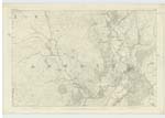
Charles Watt John Dixon | 043 | [Situation] 1/2 mile north of Kirkbride. A tolerable sized hill on the farm of Kirkbride (hence the name) its surface consists chiefly of rocky heathy pasture. On it is a Trigl. [Trigonometrical] Station called by Trigl. Party "Kilbride" |
| ARDWALL DEER PARK | Ardwell Deer Park Ardwell Deer Park Ardwall see Plan 43D |
Charles Watt John Dixon |
043 | [Situation] 3/8 mile NE by E. [North East by East] of Kirkbride. A large field well enclosed by a Stone built wall, about 6 feet in height, formerly it had been used for grazing (Deer hence the name) it is on the farm of Low Ardwell, the property of James McCulloch Esqr. of Ardwell. |
Continued entries/extra info
[Page] 21 Parish of AnwothNote: Kirkbride A church or chapel dedicated to St Bride.
Note: Ardwall from the Gaelic Ard bhaile i.e. The high Town or village.
Transcribers who have contributed to this page.
IanMcC
Location information for this page.
Linked mapsheets.