OS1/20/127/17


| List of names as written | Various modes of spelling | Authorities for spelling | Situation | Description remarks |
|---|---|---|---|---|
| CAULDSIDE STEPS | Cauldside Steps Cauldside Steps |
David Harper John Murray |
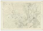
043 | [Situation] 1 1/8 miles NW by N. [North West by North] of Kirkbride. A row of Stepping Stones crossing Skyre Burn, and Situated a short distance below the junction of Caulside Burn. |
| SKYRE BURN | Skyre Burn Skyre Burn Skyreburn Skairsbourn Skyre Burn |
Charles Watt John Dixon Stat Acct. [Statistical Account] 1843 Sympson Description of Galloway P.44 Ainslies Map 1820 |
043 | [Situation] Running in a Southerly direction through the South portion of the parish of Anwoth. A Considerable Stream or burn taking its rise on the farm of Arkland and running in a Southerly direction to its influx the Sea a short distance below Skyre Burn Mill. |
Continued entries/extra info
[Page] 17 Parish of AnwothNote: Cauld, Caul, A damhead, a Small bank
Note: Skyreburn which in [?] Signifies clear burn. Stat. Acct of Kirkcudt. [Kirkudbright] 1845
Transcribers who have contributed to this page.
IanMcC
Location information for this page.
Linked mapsheets.