OS1/20/126/34


| List of names as written | Various modes of spelling | Authorities for spelling | Situation | Description remarks |
|---|---|---|---|---|
| DENDOO or DISDOW HILL | Disdow Hill Disdow Hill Disallow Hill Dendoo or Disdow Hill |
Samuel Sheriff Esqr. Samuel McLellan Stat Acct [Statistical Account] 1845 Name List for plan 44A |
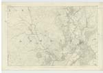
043 | [Situation] 1 1/2 Miles E.S.E [East South East] of Rusco. A considerable hill on the [summit] of Disdow, its surface consists [of] arable land with a considerable portion of it planted with wood, its summit is a Trigl. [Trigonometrical] Station [called] by Trigl. Party "Dendoo". |
| NEW BRIDGE OF BARLAY | New Bridge of Barlay New Bridge of Barlay |
James McMechan Samuel Hawthorn |
043 | [Situation] 1 Mile ESE [East South East] of Rusco. A stone built bridge of one [arch] crossing Barlay Burn on [the ?] of road leading from Gatehouse [to] Lawriestown. It is a County [bridge] |
Continued entries/extra info
[Page] 34 Parish of GirthonForm 136 Page 80 Disdow Hill
Page 83 New Bridge Barlay
Dendoo from the Gaelic Dun dubh The Black Hil
Transcriber's notes
Note: New Bridge of Barlay. Some of the right hand words under Description are obscuredTranscribers who have contributed to this page.
IanMcC
Location information for this page.
Linked mapsheets.