OS1/20/126/30


| List of names as written | Various modes of spelling | Authorities for spelling | Situation | Description remarks |
|---|---|---|---|---|
| GREY HILL | Grey Hill Grey Hill |
John Harper John Black |
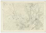
043 | [Situation] 1 3/8 mile N.E.by E. [North East by East] of Rusco. A Small hill on the farm of High Croach, the Soil of which is is arable land |
| BENFADYEON | Benfadyeon Benfadyeon Benfadyeon Benfadyeon |
John Harper John Black Ainslies Map 1820 Map of County |
043 | [Situation] About 2 miles N.E. of Rusco. A tolerable sized hill on the farm of High Croach, the Surface of which is rocky heathy pasture. On it is a [?] Station called by Trigl. [Trigonometrical] Party "Langisan". |
| LAGHEAD BURN | Laghead Burn Laghead Burn |
John Harper John Black |
043 | [Running in a S.W. [South West] direction to its junction with Lagg Burn at the N. [North] Side of Brad Hill. A Small Stream taking its [rise ?] on the farm of Laghead and running in a Southerly direction to its conflux with Drumclough Burn, thence to the Water of [?] it is called Lagg Burn. |
Transcriber's notes
Difficulty reading some of the right hand wordsContinued entries/extra info
[Page] 30 Parish of GirthonForm 136
Page 60 Grey Hill
67 Benfadyean
65 Laghead Burn
[Note] Beann fod cheann (Gaelic) A hill with long head, or Summit, Beann fod thonach A hill with a long bottom.
[Note] Lag (Gaelic) A hollow, a pit, &c.
Transcribers who have contributed to this page.
Chr1smac -Moderator, IanMcC
Location information for this page.
Linked mapsheets.