OS1/20/126/27


| List of names as written | Various modes of spelling | Authorities for spelling | Situation | Description remarks |
|---|---|---|---|---|
| DRUMCLEUGH BURN | Drumclough Burn Drumclough Burn Drumcleugh Burn |
John Harper John Black See Plan 37D |
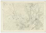
043 | [Situation] Running Southerly from Doon Hill runs into Lagg Burn 1 1/8 miles NE by N.[North East by North] of Rusco. A small Stream or burn having its rise on the farm of Lagg and running in a Southerly direction to its conflux with Laghead Burn, thence it is called Lagg Burn to its confluence with the Water of Fleet. |
| LARGOES MOOR | Largoes Moor Largoes Moor Largoes Moor Largoes Moor |
John Harper John Black John Sheriff Esqr. Map of Property |
043 | [Situation] About 1/2 Miles N.E.[North East] of Rusco. A considerable tract of Moorland on the farm of Laghead, it surface consists of heathy pasture, formerly the farm on which it is situated was called Largoes hence the name. |
| LARGOES | Largoes Largoes Largoes Largoes Largoes |
John Harper John Black Ainslies Map 1820 David Sheriff Esqr. Map of Property |
043 | [Situation] 1 1/4 Mile N.E. by N. [North East by North] of Rusco. An old house thatched and in bad repair having out houses in ruins, formerly it had a farm of land attached but is now united with that of Laghead. |
Continued entries/extra info
[Page] 27 Parish of Girthon[Note] Larg, A plain an Eminence
Note - The termination [?] is not of plain etymology without knowing the locality. It probably is a corrupn. [corruption] of the Gaelic uisgadh [?] locaiity
Transcribers who have contributed to this page.
IanMcC
Location information for this page.
Linked mapsheets.