OS1/20/126/11


| List of names as written | Various modes of spelling | Authorities for spelling | Situation | Description remarks |
|---|---|---|---|---|
| KENLUM HILL | Kenlum Hill Kenlum Hill Kenlum Hill |
William Gordon William Robertson Samuel McLellan Esqr. |
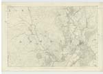
043 | [Situation] 1 1/2 Miles W. [West] of Rusco. A considerable hill on the farm of Killern and Ornockenough, its Surface consists of rocky heathy pasture, On it is a Trigl. [Trigonometrical] Station called by Trigl. Party Kenlum [?] |
| KIRKBRIDE HILL | Kirkbride Hill Kirkbride Hill |
William Gordon William Robertson |
043 | [Situation] 2 Miles S.W. by W. [South West by West] of Rusco. A tolerable sized hill on the farm of Kirkbride (hence the name) its surface consists of partly arable land and partly rocky pasture, On it is a Trigl. [Trigonometrical] Station called by Trigl. Party Kirkbride. |
| Old Military Road | Old Military Road | See Plan 43C | [Situation] Passing through the parish of Anwoth passing between Kirkbride Hill & Ardwall Hill. For description see Name Sheets for plan 43C. |
Continued entries/extra info
[Page] 11 Parish of Anwoth[Note] Kirkbride A Kirk or Chapel dedicated to St Bridget
Transcriber's notes
Kenlum Hill - Last word under Description illegibleTranscribers who have contributed to this page.
IanMcC
Location information for this page.
Linked mapsheets.