OS1/20/115/17


| List of names as written | Various modes of spelling | Authorities for spelling | Situation | Description remarks |
|---|---|---|---|---|
| MAIDENPAP | Maidenpap Maidenpap Maidenpap Maidenpap Maidenpap Hill |
J Cameron J Wightman Rev. [Reverend] J. Crocket W. J. Johnstone Ainslies Map 1820 |
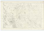
040 | A hill of considerable elevation on the farm of Drumcow its surface consists of heathy pasture. On it is a Trig. [Trigonometrical] Station called by Trigl. [Trigonometrical] Party " Maidenpap" From the summit of this hill an extensive view of the surrounding country can be obtained. It is a conspicuous part of a range connected with Drumcow Hill. |
| DRUMCOW BURN | Drumcow Burn | John Clark B. Boyd Ainslies Map 1820 See Names List Plan 41A |
040 | A small stream or burn having its rise on the farm of Plascow and running in a southerly direction passing through the lands of Drumcow |
Continued entries/extra info
Parish of Colvend -- [page] 17[Under situation column for Maidenpap]
1½ miles SE by S [ South East by East] of Plascow Farm house
[Under situation column for Drumcow Burn]
About 1½ miles SE by E [South East by East] of Plascow
Transcribers who have contributed to this page.
DANIALSAN, GavinCraig
Location information for this page.
Linked mapsheets.