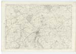
OS1/20/112/18
| List of names as written | Various modes of spelling | Authorities for spelling | Situation | Description remarks |
|---|---|---|---|---|
| KELTON MAINS | Kelton Mains Kelton Mains Kelton Mains |
John Robertson, Rae William Kirkpatrick Valuation roll 1819 |
039 | [Situation] About 1 1/8 miles N. [North] by E. [East] of the village of Rhonehouse. A modern stonebuilt house two stories high and was formerly the mansion to the Kelton Estate. It is now a farm house having [suitable] offices & a farm of 147 acres of land attached exclusive of plantations several of which are upon the lands. |
| CARLINGWARK LANE | The Lane or Canal The Lane or Canal Canal Carlingwark Lane Carlingwark Lane Carlingwark Lane |
John Robertson, Rae William Kirkpatrick Ainslies map 1820 John R. Rae James McAdam Robert Murray. |
039 | [Situation] At the north side of the Parish of Kelton extending in a S.E. [South East] direction from the River Dee at threave Island to Carlingwark Loch. An artifical cut extending from the N.W. [North West] side of Carlinwark Loch to the River Dee & near the N. [North] end of [threave] Island. It was cut about the year 1777 for the convenience [of] boats conveying marl from the Loch of Carlingwark to the upper districts of the country |
Continued entries/extra info
[Page] 18 -- Parish of KeltonForm 136
Page 50 - Kelton Mains
Page 50 - Carlingwark Lane
[Note after Kelton Mains] Mains The farm attached to a mansion house
Jamiesons Scottish Dicty [Dictionary]
[Note about Carlingwark Lane] The Lane or Canal. "Car-lin i.e. The fort-
lake to which is added the
Scots-Saxon wark"
Note - This has not been used
as a navigable canal for
many years past.
[W S] [Loop] Corpl [Corporal]
RSM [Royal Sappers & Miners]
[Note] See also Name List Plan 39D
Transcribers who have contributed to this page.
Chr1smac -Moderator, raschdorff
Location information for this page.
Linked mapsheets.


