OS1/20/103/35


| List of names as written | Various modes of spelling | Authorities for spelling | Situation | Description remarks |
|---|---|---|---|---|
| GROBDALE LANE | Samuel McClelland Esq. Gatehouse of Fleet John Ferguson Esq. Gatehouse of Fleet Ainslies Map revised 1819 |
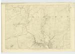
037 | A tolerable sized stream taking its rise on the farm of Darngarroch, it does not meander a great distance until it becomes the boundary between the parishes of Girton & Balmaghie & continues so until it falls into The Black Water of Dee, near Barnie Water, after it leaves Grobdale farm, it is called Airies Burn from that farm & by some Auchencloy Burn until its confluence with the Dee | |
| CLACK HILL | John Ferguson Girthon Grobdale John Brown Esq Gatehouse of Fleet |
037 | A tolerable sized hill on the farm of Balmaghie Grobdale the surface of which consists of rky [rocky] [II] Pastue [Pasture] it takes its name from being on the quondam farm of Clack. upon its summit stands a [triangle sign] station, called by Trig [Trigonometrical] party Green Hill. |
Continued entries/extra info
List of Names collected by John Mechan Lce [Lance] Corpl [Corporal] RSM [Royal Sappers & Miners] -- Final Examiner -- [page] 35 -- [1st entry][Parish of] Girthon and Balmaghie] -- [2nd entry] [Parish of] BalmaghiePlan 37B
Objects
Grobdale Lane - A Burn
Clack Hill - A Hill
[Signed] 16th August 1848 John Mechan Lce [Lance] Corpl [Corporal] RSM [Royal Sappers & Miners]
W Driscoll Gosset Lt [Lieutenant] R. [Royal] Engs [Engineers] Oct [October] [4 148]
Transcriber's notes
Words are missing in fold on left hand side.Transcribers who have contributed to this page.
raschdorff
Location information for this page.
Linked mapsheets.