OS1/20/103/15


| List of names as written | Various modes of spelling | Authorities for spelling | Situation | Description remarks |
|---|---|---|---|---|
| EWE HILL | Ewe Hill Ewe Hill Ewe Hill |
John Brown Esqr. John Ferguson Ainsley's Map revisd [revised] 1819 |
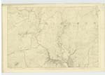
037 | [Situation] 1 1/2 miles E. [East] by S. [South] of Burnfoot (in ruins). A considerable hill on the farm of Girthon Grobdale the surface of which is rocky heathy pasture On it is a Trigl [Trigonometrical] Station called by Trigl [Trigonometrical] Party [afer] the name of the hill. |
| QUEEN'S RIG | Queen's Rig Queen's Rig |
John Ferguson John Denniston |
037 | [Situation] 1 3/8 miles E [East] by N. [North] of Burnfoot (in ruins) and north of Ewe Hill. A small ridge consisting of heathy pasture situate between Ewe Hill and Laughenghie Hill. A Ewe which the farmer's family styled The Queen of the Flock died here hence the name. It is generally known in the locality. |
Continued entries/extra info
Parish of Girthon -- [page] 15[Form 136]
Page [...] - Ewe Hill
Page [...] - Queen's Rig
Transcriber's notes
Words are missing in fold on left hand side.Transcribers who have contributed to this page.
raschdorff
Location information for this page.
Linked mapsheets.