OS1/20/102/5


| List of names as written | Various modes of spelling | Authorities for spelling | Situation | Description remarks |
|---|---|---|---|---|
| CRAIGLOWRIE | Craiglowrie Craiglowrie Lowrie Craig |
John Brown Esqr Samuel McLelland Ansley Map (1819) |
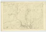
037 | [Situation] About 13/4 Miles N W [North West] by N. [North] of MeiKle Cullendoch A large hill on the farm of Morrowton the Soil of which is Rough Rocky Pasture On its Summit is a Trigl, [Trigonometrical] Station Called by Trigl. [Trigonometrical] Party "Craiglowory" Most probably it taKes its name from a man Called Lowrie. |
| POIND FAULD | Pound Fold Pound Fold Pound Fold Poind Fauld Poind Fauld |
Alexander McGaw John Gardiner Samuel McLelland Esqr D. Sheriff Esqr John Ferguson |
037 | [Situation] About 11/8 mile N. W. [North West] by N. [North] of MeiKle Cullendoch A Square enclosure formed by Rudely Constructed Fences. which stands about 41/2 feet in height A Streamlet Called Eglon Cleugh Burn passes through it. It was erected as a penfold for Cattle which chanced to Stray from adjoining farms. until Money for trespass was paid by their Owners It is on the farm of Mrrowton. - |
Continued entries/extra info
Parish of Girthon -- [Page] 5Poind - to distance to Shut up (Jamiesons Scottish Dictionary,
Transcribers who have contributed to this page.
Molly Miller
Location information for this page.
Linked mapsheets.