OS1/20/102/13


| List of names as written | Various modes of spelling | Authorities for spelling | Situation | Description remarks |
|---|---|---|---|---|
| CAIRN TAMMOCK | Cairn TammocK Cairn TammocK Cairn TammocK |
William McMichael Samuel McLelland Esqr William StarK |
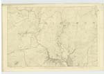
037 | [Situation] 7/8 Mile E [East] by S. [South] of MeiKle Cullendoch A Small portion of elevated land on the Summit of the Rig of DrumrucK on it is a Trigl. [Trigonometrical] Station Called by Trigl. [Trigonometrical] Party "Rig of DrumrocK" |
| LANE FOOT | Lane Foot Lane Foot |
William McMichael Samuel McLelland Esqr, |
037 | [Situation] About 3/8 Mile South of MeiKle Cullendoch A Bend in the Big Water of Fleet. and the influx of a Small Stream which gaves rise to the name. - |
| RIG OF DRUMRUCK | Rig of Drumruck Rig of Drumruck Rig of Drumruck Rigg of DrumrucK |
William McMechael Samuel McLelland Esqr William StarK Ansly's Map revisd [revised] 18[2]9 |
037 | [Situation] About 7/8 mile E [East] by S [South] of MieKle Cullendoch A large hill of a Ridge liKe Shape on the farms of Morroyton and MeiKle Cullendoch the Surface of which is Rough rocky heathy pasture. Rig, is the Scotch term for Ridge. - |
Continued entries/extra info
Parish of Girthon -- [Page] 13Page
37 Lane Foot
37 Rig of Drumruck
37 Cairn Tammock
TammocK, a hillocK spot of elevated grass. Jamiesons Dictionary
Transcribers who have contributed to this page.
Molly Miller
Location information for this page.
Linked mapsheets.