OS1/20/101/19


| List of names as written | Various modes of spelling | Authorities for spelling | Situation | Description remarks |
|---|---|---|---|---|
| CRAMMERY HILL | Crammery Hill Crammery Hill Cramy Hill Cramy Hill |
John Burnie John Garroch Ainslies Map 1820 Map of County |
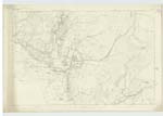
036 | [Situation] About 21/2 mileS N. E. [North East] of Craig (house) A Small hill on the farm of Bardrochwood, its Surface Consists of RocKy heathy pasture, On its Summit is a Trigl. [Trigonometrical] Station Called by Trigl. [Trigonometrical] Party "Bardrahad". |
| GRADDOCK BURN | GraddocK Burn GraddocK Burn GraddocK Bourn GraddocK Burn |
John Burnie John Garroch Symson's Description of Galloway page 47 Name List - 36. B |
036 | [Situation] Running S. W. [South West] past the E. [East] Side of Crammery Hill & forming part of the parish By [Boundary] between Minnigaff and KirKmabreck. A Small Stream or burn taKing its Rise on the West Side of Cairnsmore between the farms of Cuil and Bardrochwood, And Running in a Westerly direction (forming part of the boundary line betwixt the parishes of Minnigaff & KirKmabrecK) to its influx with P[a?]mure Burn. |
Continued entries/extra info
Parish of Minnigaff -- [Page] 19Form 136 Page
31 Crammery Hill
31 Graddock Burn
Transcribers who have contributed to this page.
Molly Miller
Location information for this page.
Linked mapsheets.