OS1/16/8/84


| List of names as written | Various modes of spelling | Authorities for spelling | Situation | Description remarks |
|---|---|---|---|---|
| CAMAS BAN | Camas Bàn | Revd. [Reverend] John Darroch Revd. [Reverend] A. Martin Angus Macpherson Ainslie's Map. Johnston's Map |
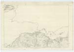
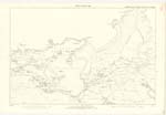
030 | Applies to a small bay about ½ mile wide and lies about ½ mile east of Portree. A portion of the foreshore is covered with sand but the greater part with stones signifies "White Bay" |
| SCORR (In Ruins) | Scorr | Revd. [Reverend] John Darroch Revd. [Reverend] A. Martin Angus Macpherson Ainslie's Map. Johnston's Map |
030 | Is applied to the ruins of a few houses. Situated near Scorr Burn they are surrounded by rough pasture and are the property of Lord MacDonald Anglicised |
| VRISKAIG POINT | Vriskaig Point | Revd. [Reverend] John Darroch Revd. [Reverend] A. Martin Angus Macpherson Ainslie's Map. Johnston's Map |
030 | It is applied to a headland forming the western boundary of "Camus Ban" and lying about ½ mile east of Portree Signification obscure Lord MacDonald. proprietor |
Continued entries/extra info
[Page] 84County of Inverness -- Parish of Portree
Transcribers who have contributed to this page.
Bizzy- Moderator, Gordon S Brown
Location information for this page.
Linked mapsheets.