OS1/16/6/79


| List of names as written | Various modes of spelling | Authorities for spelling | Situation | Description remarks |
|---|---|---|---|---|
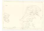
| LORGILL | Lorgill Lorgill Lower Gill |
Mr. A. McNeill Mr. McDonald Admiralty Chart Johnston's Map. Black's Map. Val. [Valuation] Roll |
026 | This name is applied to a small valley partly cultivated & under crofters. It is situate 2 miles south east from Ramsaig. The only road communication between these & to these two places is a very inferior foot path, in some places so badly defined that a person is apt to lose it. The houses in Ladhargill are similar to those in Ramsaig. Sir John McLeod is proprietor |
| LORGILL RIVER | Lorgill River | Mr. A. McNeill Mr. McDonald |
026 | Is applied to a large stream flowing from Loch Einadal and through Lorgill into the sea Signification "Lorgill River" |
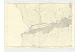
| CREAG NA H-AIRIDH | Creag na h-Ahiridh | Mr. A. McNeill Mr. McDonald |
026 | Signifies "Rocks of the shealing" and is applied to a steep rocky face on the east side of Lorgill. |
| LORGILL BAY | Lorgill Bay | Admiralty Chart | 026 | A small Bay Situated at the Southern End of the district of Lorgill and about 1/2 mile E. [East] of Hoe Point. |
Continued entries/extra info
[Page] 79Isle of Skye -- County of Inverness -- Ph [Parish] of Durinish
Lorgill [note] wrongly copied [initials]
Transcribers who have contributed to this page.
Bizzy- Moderator
Location information for this page.