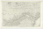
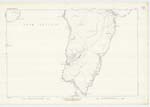
OS1/18/12/5
| List of names as written | Various modes of spelling | Authorities for spelling | Situation | Description remarks |
|---|---|---|---|---|
| STONEYBRIDGE | Stoneybridge Staoinebrig Steinibrigh Stonybridge |
Mr Roderick McMullan Farmer, Pennuereine, South Uist. Val. [Valuation] Roll 1868-9 p [page] 100 Admiralty Chart A A carmicchael Esq. Johnston's Map New Stat. [Statistical] Account |
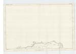
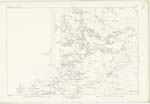
050 ; 053 | This name applies to a district, chiefly cultivated, comprising several small farms or crofts, the houses of which are each one storey in height, thatched and in bad repair, the dimensions of the district is about one mile from East to West, and about the same from North to South. It is situated about one mile to the North of "Ormaclate", and about eight miles South of "Carnan Inn", at "S. [South] Ford." property (as the whole island is) of J. Gordon Esquire, Cluny Castle, Aberdeenshire |
| RUDH' ARD-MHICHEIL | Rudh' Àrd Mhicheil Ard Michail Ru Ardmichail Ru Ard Michail |
R. McMullan A A carmichael Esq. Black's Map Admiralty Chart Johmnston's Map |
053 | This name is applied to a headland about one mile to the N.N. [North North] West of Ormaclate, and a little to the south West of Stoneybridge. It signifies "Michael's Headland." property of John Gordon Esquire. On the East side of this point are two modern burial grounds and they are still used by the Inhabitants for Interments |
Continued entries/extra info
[Page] 5County of Inverness -- South Uist
Transcribers who have contributed to this page.
Larry mag
Location information for this page.
Linked mapsheets.


