OS1/17/2/59


| List of names as written | Various modes of spelling | Authorities for spelling | Situation | Description remarks |
|---|---|---|---|---|
| ALLT A' CHOIRE BHUIDHE | 060 | |||
| CREAG A' GHREUSAICHE | Creag a' Ghreusaiche Creag a' Ghreusaiche Creag a' Ghreusaiche |
Mr McIntosh Revd [Reverend] N McIntyre Mr Galbraith |
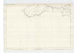
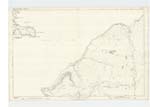
059 ; 074 | A small rocky hill lying on the northern side of Rothiemurchus estate, and forming part of the boundary between it, and Kincardine and about a quarter of a mile to tyhe west of the Slugan It is wooded to the top, and forms the boundary of theGlenmore deer forest It means the Shoemaker's Rock |
Continued entries/extra info
[Page] 59County of Inverness
Milton Burn For Authorities & description see Name Book of Abernethy and Kincardine of 1/2500 work
General Wade's Military Road- For Authorities & description see Name Book of Abernethy and Kincardine of 1/2500 work
Transcriber's notes
Rather confusing page. Pre-populated with 'Allt A. Choire Buidhe' which does not appear, but is in the Index referenced to this page. 'Milton Burn' and 'General Wade's Military Road' do appear in the page but are not pre-populated, and also appear in the Index. The latter refer to spelling authorities in name book of Abernethy and Kincardine but without page numbers. The page has no parish heading but is in fact in Duthil and Rothiemurchus parish.These two sites extend in to Abernethy and Kincardine parish and the authorities are in Vol 01 p80 ( OS1/17/1/80) for Milton Burn and Vol 01 p5 (OS1/17/1/5) for Wade's Road.
There are many 'Allt A' Choire Bhuide' names in Mainland Inverness. It is likely that the name and entry are mistakenly in the Index and refer in fact to the same name in the Inverness Vol 4 page 30 ( OS1/17/4/30). On that page there is a marginal note in pencil 'In Name Book of Duthil & Rothiemurchas'.
I leave it to Mods to decide what should be deleted.
Transcribers who have contributed to this page.
BillR
Location information for this page.
Linked mapsheets.