OS1/14/69/51


| List of names as written | Various modes of spelling | Authorities for spelling | Situation | Description remarks |
|---|---|---|---|---|
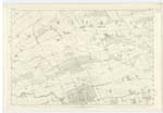
| DUNS WOOD | Duns Wood Duns Wood Duns Wood |
Mr. Will, Wester Brechin Estate Map of Balhall John Watson Ledmore |
026 | This name is applied to a large wood now principally fir, extending from parish road on the north to parish boundary on the South (Traces 2 & 3 of this Plan), and from public road on the east (in the strip of R P [Rough Pasture] Trace 3), to public road which forms part of the parish boundary on the west - Trace 1 & 2. |
| WEIRIS BURN | Weiris Burn Weiris Burn Weiris Burn |
Mr. Will Estate Map of Balhall John Watson |
026 | A small stream having its rise in Fearn Parish, pursues an Easterly course, through "Duns Wood" and bears the name not further than Mill Dam, Near "F C [Free Church] Manse" 26.11 Trace 1. |
Continued entries/extra info
[Page] 51County Forfar -- Ph. [Parish] of Menmuir
Weiris Burn [note]
Authenticated in N. [Name] Book of Fearn Ph. [Parish]
Transcribers who have contributed to this page.
Alison James- Moderator, Caspell
Location information for this page.
Linked mapsheets.