OS1/14/63/82


| List of names as written | Various modes of spelling | Authorities for spelling | Situation | Description remarks |
|---|---|---|---|---|
| MOUNT BATTOCK | Mount Battock Mount Battock Mount Battock Mount Battock Mount Battock Mount Battoch |
New Stat. [Statistical] Account County Map Land of the Lindsays Mr. Stocks Factor Rev. [Reverend] W. Low Fullarton's Gazetteer |
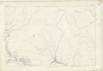
007 | One of the highest mountains in Forfarshire and second in importance to "Mount Keen", It rises high above all the hills around it, and is a prominent object in some directions for 30 miles. It has two tops the "Wester Cairn" forming one, and the point where the Trigl. [Trigonometrical] Station is the other, Derivation Monadh Badach The mountain abounding in groves, thickets &c. with which nearly all of those hills were at one time more or less abundant. [Initialled] T.B. "Mount Battock is 3465 feet high" New Stat. Acct. [Statistical Account] |
| WESTER CAIRN | Wester Cairn Wester Cairn Wester Cairn |
James Caithness, Shank Duncan Michie, Ground Officer Charles Christison, Glentennet |
007 | A prominent feature forming the Western top of "Mount Battock". |
| BLACK CRAIG | Black Craig | James Caithness, Shank Duncan Michie, Ground Officer Charles Christison, Glentennet |
007 | A few scattered rocks on the Southern side of Mount Battock |
Continued entries/extra info
[Page] 82Co. [County] of Forfar -- Parish of Lochlee
Transcribers who have contributed to this page.
Alison James- Moderator, KBMW- Moderator
Location information for this page.
Linked mapsheets.