OS1/14/63/7


| List of names as written | Various modes of spelling | Authorities for spelling | Situation | Description remarks |
|---|---|---|---|---|
| MOUNT KEEN | Mount Keen Mount Keen Mount Keen Mount Keen Mount Keen Mount Keen |
New Statistical Account County Map Land of the Lindsays Rev. [Reverend] W. Low Mr. Stocks, Factor Fullarton's Gazetteer |
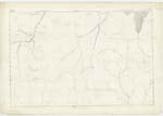
002 | A high mountain on the boundary between the Counties of Forfar and Aberdeen, It rises high above all the mountains around it and terminates in a peaked top a few yards in diameter, on the summit of which are two layers of granite remarkable from a distance, The Public road from Invermark to Ballater passes over its Western shoulder, - It is the highest and most remarkable mountain in Forfarshire. * "The elevation of Mount Keen (the summit of which forms the boundary between the Counties) is about 4000 feet," New Statistical Account. * "Mount Keen" is a subordinate feature compared with "Glas Maol" and others in the County - the former is 3072 feet, the latter 3501 feet. |
| BRAID CAIRN | Braid Cairn Braid Cairn Braid Cairn Braid Cairn |
Archibald Campbell, Inchgrundle James Mitchell Glenmark Rev. [Reverend] W. Low Co. [County] Map |
002 | A hill very little inferior in elevation to the above but by no means so remarkable in appearance, from the flatness of the top, which causing it in a great measure to blend with the hills around it, robs it of a great deal of its importance - Braid a Scotch word signifying Broad - Cairn from Carn. |
Continued entries/extra info
[Page] 7County of Forfar -- Parish of Lochlee
Mount Keen [note]
Derivation from Monadh and Ceann, The head
or principal mountain
Transcribers who have contributed to this page.
Alison James- Moderator, KBMW- Moderator
Location information for this page.
Linked mapsheets.