OS1/14/52/3


| List of names as written | Various modes of spelling | Authorities for spelling | Situation | Description remarks |
|---|---|---|---|---|
| KETTINS [parish] | Kettins Kettins Kettins Kettins Kettins Kettins Kettins |
Sheriff's List of Meresmen New Stat. Acct. [Statistical Account] Johnston's Co. [County] map Old Stat. Acct. [Statistical Account] Fullarton's Gazetteer Oliver & Boyd's Almanack Valn. [Valuation] Roll 1857-8 |
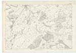
042; 048 | [Situation] In the SW [South West] end of Forfarshire. A parish in the South-west extremity of Forfarshire, bounded on the north-east by Newtyle, on the east by Lundie on a small part of the west by the Forfarshire portion of Coupar Angus and on the other sides by Perthshire. It has nearly the figure of a hexagon its south-east considerably indented, two sides ragged or irregular and each of the six measuring on an average about 2[ ] miles. But a detached portion one mile long and ¾ mile broad, lies 6 miles south-west from the nearest point of the main body, surrounded by Collace Kinnaird Kilspindie and St. Martin in Perthshire. The east side of the main body being bounded by the water-shedding line of the Sidlaw hills, the surface first descends the slope of these hills and then glides gently down into the plain of Strathmore. The greater or western part is nearly level and well cultivated [continued on page 4] |
Continued entries/extra info
[Page] 3Parish of Kettins
Transcriber's notes
Missing number not visible on original film .Transcribers who have contributed to this page.
Chr1smac -Moderator, Alison James- Moderator
Location information for this page.