OS1/13/85/19


| List of names as written | Various modes of spelling | Authorities for spelling | Situation | Description remarks |
|---|---|---|---|---|
| EAST PITKIERIE | East Pitkierie East Pitkierie East Pitkierie E. Pitkeiry |
George Todd Occupier Plan of the farm, 1836 Wiliam Band Farmer West Pitkierie Johnston's Co. [County] Map |
020 | [situation] About 1 1/4 miles N.W. by W [Northwest by West] from Kilrenny. A newly erected farm steading with dwelling House, of 2 stories Occupied by George Todd, and the property of Andrew Johnston Esq. Banker, Halesworth, Suffolk. |
| WEST PITKIERIE | West Pitkierie West Pitkierie West Pitkeiry |
William Band Occupier George Todd Farmer East Pitkierie Johnston's Co. [County] Map |
020 | [situation] About 1 1/4 miles W.N.W. [West North West] from Kilrenny. A large farm steading with dwelling house of 2 stories The farm is about 129 acres in extent. Occupied by William Band and the property of Andrew Johnstone Esq. Banker, Halesworth, Suffolk. |
Continued entries/extra info
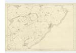
19 Parish of Kilrenny Plan 20C Trace 3[signed] James Ireland c/a [Civilian Assistant] June 23rd 1853
Transcribers who have contributed to this page.
MaxInSpain
Location information for this page.
Linked mapsheets.