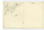
OS1/13/77/9


| List of names as written | Various modes of spelling | Authorities for spelling | Situation | Description remarks |
|---|---|---|---|---|
| DOWNANS PLANTATION | Downans Plantation Downans PLantation Downans PLantation Downing Plantation Downing Plantation |
Property Map Mr. James Asher Mr. John White Property Map (new) Mr. Smith. Forester. |
040 | [siuation] About 1/8 Mile N.E. [Northeast] of St Colm House. A hill thickly planted with Fir & other Forest timber. previous to its being planted it bore this name. The word "Downans" signifies "a green hillock" - and probably from this the name was derived. [Note] Downans Green Hillock Jameson |
| LITTLE CRAIGS | Little Craigs Little Craigs Little Craigs Little Craigs Little Craigs |
William Moubray Esqr. R.N. [Royal Navy] Revd. [Reverend] H. Ralph LLD [Doctor of Laws] Mr. J. Asher J. White Well Known among the Boatmen etc. of the neigbourhood. |
040 | [situation] About 3/4 mile E. by N. [East by North] of St. Colm House. Two small sunk rocks. visible at low water of common tides. situated south of the mouth of Aberdour Harbour, and is very well known by this name, in the locality. |
| SWALLOW CRAIG | Swallow Craig Swallow Craig Swallow Craig Swallow Craig Craig Swallow Craig Swallow |
Mr. James Black, Innkeeper and boatman. Aberdour J. White James Asher William Dave. Aberdour William Kirkham Robert Beveridge Aberdour |
040 | [situation] Off the N.E. [Northeast] point of Inchcolm island. A large rugged rock at the NE [Northeast] point of Inchcolm visible at the highest spring tides and connected to the island at low water, but a large boat may pass between them at half tide. derivation unknown. |
Continued entries/extra info
9 Plan 40A Parish of DalgetyTranscribers who have contributed to this page.
MaxInSpain
Location information for this page.
Linked mapsheets.