OS1/13/76/25


| List of names as written | Various modes of spelling | Authorities for spelling | Situation | Description remarks |
|---|---|---|---|---|
| BIMAR | Bimar Bimar Bimar Bimar Beemer Bimer |
Chalmers' His [History] of Dunf. [Dunfermline] Map of Fife and Kinross Mr William Pringle, Surveyor Mr Fraser, Ferry Barns Gellatlys' Map of the country 12 mile round Edinburgh Chart of the Firth of Forth |
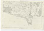
039 | A small rocky Island in the Firth of Forth on which is a Stone Beacon 27 feet in height and 13 in diameter as a protection to vessels at high water, when the island is covered |
| LONG CRAIG | Long Craig Long Craig Long Craig Long Craig |
Mr William Pringle Chalmers' His [History] of Dunf. [Dunfermline] Mr Fraser Mr Grant |
039 | A rocky island on the north side of the Firth of Forth and about 1/4 of a mile west by south of North Queensferry it is nearly covered at high water |
| WELLDEAN QUARRY (Freestone) | Welldean Quarry | Mr Hogg, Culross J. Allan, Inverkeithing |
039 | A Freestone quarry on the W [West] side of the Ferry Hills near to St [Saint] Margarets Hope |
Continued entries/extra info
25 [right corner of header]Plan 39 D Parish of Dunfermline Detached
5/8 of a mile SW [South West] by west of Northcliff [Situation for Bimar]
About 1/4 of a mile SW [South West] of Northcliff [Situation for Long Craig]
At St [Saint] Margaret's Hope [Situation for Welldean Quarry]
Transcriber's notes
Bimar. The modern name for this rock was "Beamer". During 2013 the beacon was dismantled and the components stored ashore. Thereafter the rock was blown up and the site incorporated in the foundations of the central tower for the new Forth Replacement Crossing bridge, to be called "Queensferry Crossing".Welldean Quarry. Although only one spelling is given, two authorities are listed.
Transcribers who have contributed to this page.
MaxInSpain , JCB
Location information for this page.
Linked mapsheets.