OS1/13/71/11


| List of names as written | Various modes of spelling | Authorities for spelling | Situation | Description remarks |
|---|---|---|---|---|
| KEMPEL BANK | Kempel Bank Kempel Bank Kempel Bank Kempel Bank |
Revd. [Reverend] James Hardie Kinghorn. Harbour Map Mr. Jeffrey Station Master Kinghorn Mr. Davidson, teacher Burntisland. |
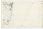
037 | [situation] 1/2 Mile S. [South] of the town of Kinghorn. A bed of Sand, surrounded on th NE [Northeast] & West, by low rugged rocks, and situated near the shore at Pettycur Inn (on the adjoining Plan) |
| PETTYCUR | Pettycur Pettycur Pettycur Pettycur Pettycur Pettycurr |
Revd. [Reverend] J. Hardie Mr. Jeffrey Mr. Davidson New Stat. Acct. [Statistical Account] Old Stat. Acct. [Statistical Account] Johnston's Co. [County] Map |
037 | [situation] About 1/2 Mile S. [South] of the town of Kinghorn. A small hamlet on the north bank of the Firth of Forth, about 1/2 a mile distant from Kinghorn on the North. the village is occupied by fishermen and those engaged in the coke ovens adjacent. It has a small harbour & pier, used for the coal trade. there was a Ferry here prior to the construction of the Edinburgh, Perth & Dundee Railway. It has one Public House of the common description. |
| KINGHORN NESS | The Thirley Rocks or Kinghorn Ness The Thirley Rocks or Kinghorn Ness The Thirley Rocks or Kinghorn Ness Kinghorn Ness Kinghorn Ness |
Harbour Map Revd. [Reverend] J. Hardie John Burrell, Fisherman Kinghorn Johnston's Co. [County] Map New Stat. Acct. [Statistical Account] |
037 | [situation] About 1/2 Mile S. [South] of the Town of Kinghorn. Low rugged rocks situated on the shore near Pettycur, well known to fishermen. |
Continued entries/extra info
11 Pln 37C Kinghorn Parish[Note] Ness, A promontory. Jameson.
Transcribers who have contributed to this page.
MaxInSpain
Location information for this page.
Linked mapsheets.