OS1/13/68/4


| List of names as written | Various modes of spelling | Authorities for spelling | Situation | Description remarks |
|---|---|---|---|---|
| BUTTER ROAD | Butter Road Butter Road Butter Road Butter Road |
Revd [Reverend] Mr Little (Milnathort) Mr Robinson (Touchy) Mr Waldie (Craigow Hill) Mr David Reid (Milnathort) |
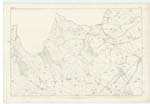
015 | [Situation] Passing the E. [East] side of Peat Hill A mountain road now disused but along which the public have a right of way. It enters the hill at the west end of Knock Wood & extends in a south westerly direction to Carnbo |
| SLUNGIE HILL | Slungie Hill Slungie Hill Slungie Hill |
Mr Waldie, Mr Millar senr [senior] David Reid |
015 | [Situation] 2 miles N.W. [North West] of Criago Mill A prominent hill feature in the Ochil range, on the summit of which stands a Trigl [Trigonometrical] station. The boundary between the Parishes of Forgandenny & Orwell crosses the north side of the hill. |
| CAIRN (Site of) | Cairn site of Cairn site of Cairn site of Slungie Cairn |
Mr Waldie Mr Millar senr [senior] David Reid Bell's Co [County] Map |
015 | [situation] On Slungie Hill A small elevation on the summit of Slungie Hill. No direct testimony be obtained as to its origin or use, but Mr Waldie who pointed out the site states, that it is supposed that a Beacon was placed here at one time to convey intelligence between Edinburgh & Dundee, both of which places can be seen on a clear day from the summit of the hill. |
Continued entries/extra info
[Page] 4Plan 15.C. -- Parish of Orwell
Cairn [Note] There is no historical notion of this cairn in this office JH
Transcribers who have contributed to this page.
Trondragirl- Moderator, Serendipity
Location information for this page.
Linked mapsheets.