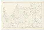
OS1/13/67/23


| List of names as written | Various modes of spelling | Authorities for spelling | Situation | Description remarks |
|---|---|---|---|---|
| ARLICK HILL | Arlick Hill Arlick Hill Arlick Hill |
Mr. J. Niven Mr. D. Burt County Map |
119; 015 | [situation] 3 1/4 Miles N.W. [Northwest] by W. [West] of Duncrevie. A Hill on the North side of Plains having a Trig. [Trigonometrical] Station it forms part of the Ochil Range and from its summit is an extensive view of the surrounding country. |
| PLAINS BURN | Plains Burn Plains Burn Plains Burn Blair Burn |
Mr. John Niven Mr. D. Burt Mr. James Niven County Map |
015 | [situation] Passing a short distance East by Plains farm ho [House]. A stream of Burn which has its source in the lands of Tilliery flowing from thence to the old road from Milnathort to Strathearn from the latter place it takes a N [North] & NE [Northeast] direction to its junction with the River Farg; the whole of the burn shewn on trace 6 is a property boundary separating the lands of the Plains from Candy and Blair Farms. |
Continued entries/extra info
23 Plan 15B Trace 6 Parish of Arngask County of KinrossTranscribers who have contributed to this page.
MaxInSpain
Location information for this page.