OS1/13/29/16


| List of names as written | Various modes of spelling | Authorities for spelling | Situation | Description remarks |
|---|---|---|---|---|
| LOMOND HILLS | Lomond Hills Lomond Hills Lomond Hills Lomond Hills |
O T Bruce Esqr Mr F Howden Mr C Gullen Town Clerk New Stat. Acct. [Statistical Account] |
016 | An extensive tract of high land extending in a Westerly direction from Purin Hill or Sheet line to the West Lomond which is the Western extremity of the plan, the Lomond Hills extends to the Western base of the last named Hill and is altogether in length on or about 4 1/2 miles and averaging in width about 60 chs. [chains], the East & West Lomonds are about equidistant from the East and West ends of the range towering high above the whole of the surrounding country. The Lomond Hills includes Purin Hill Gask Hill Craigmead Falkland Moss Balharvie Moss Bracks Lairds Faulds Greenhill part of and Black Hill the places named are the highest ridge of the Hills sloping down on Side and end |
Continued entries/extra info
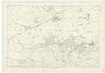
[page] 16Plan 16D Parishes of Falkland & Strathmiglo
[continued from previous page] "which would not disgrace a modern engineer; and on the South side there is a ditch about 100 yards below the summit, and nearly 200 yards long, which has either been filled in at the East end or never finished. The remainder of it is about 6 feet deep, and the earth is thrown up in the inside to form a rampart, which is still in excellent presentation." New Stat. Acct. [Statistical Account].
Mention is made in Full. [Fullarton's] Gazetteer, That upon this range of hills, and their neighbourhood, there are many fortifications, 3 of which upon the lands of Glasslies, and a chain of 8 or 9 near the West side of Green hill. None of these can be authenticated by the people of the locality or identified upon Plan by the Examiner. See Examiner's remarks attached hereto.
Transcribers who have contributed to this page.
MaxInSpain , Jill S
Location information for this page.
Linked mapsheets.