OS1/13/28/19


| List of names as written | Various modes of spelling | Authorities for spelling | Situation | Description remarks |
|---|---|---|---|---|
| HARPERLEAS | Harperleas Harperleas Harperleas Harperleys |
Major Wilson. Mr. Lawrie. Mr. Todd. Frazers Co. [County] Map. |
016 | [situation] 1 1/2 miles East of Glenvale farm house. A district of land consisting of about 100 acres lying along the south side of Glen Burn and forms the north East Corner of the Parish of Portmoak (see name book of 16D) |
| BISHOP HILL | Bishop Hill Bishop Hill Bishop Hill Bishop Hill Bishops Hill Bishop's Hill Bishop's Hill |
Revd. Dr. [Reverend Doctor] McKelvie Mr. Todd. Mr. Lawrie. Frazers County Map. Bells County Map. New Stat. Acct. [Statistical Account] Old Stat. Acct. [Statistical Account] |
016 | [situation] 1 1/4 miles S.E. [Southeast] of Glenvale farm house. A very large hill immediately south of, but totally unconnected with the Lomond Range. The Hill is very steep and precipitous on the South and West sides. it forms one of the most conspicuous features in the neighbourhood and is chiefly Heathy Pasture Land |
Continued entries/extra info
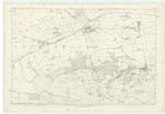
19 Plan 16C Parish of Portmoak.Transcribers who have contributed to this page.
MaxInSpain
Location information for this page.
Linked mapsheets.