OS1/13/27/30


| List of names as written | Various modes of spelling | Authorities for spelling | Situation | Description remarks |
|---|---|---|---|---|
| CRAIGEN GAW | Craigen Gaw Craigen Gaw Craigen Gaw Craigen Gaw |
Mr. Howden. [Award] Map Estate Map James Shepherd, Strathmiglo. |
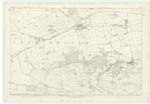
016 | [situation] 2 miles S.W. [South West] of Strathmiglo. A rocky chasm on the N.E. [North East] [brow] of the Lomond Hills, of basalt[ic] rock. |
| TOD STONES | Tod Stones Tod Stones Tod Stones |
Mr. Skinner. Mr. Senior. Mr. Tod. |
016 | [situation] 1 7/8 miles S.W. [South West] of Strathmiglo. A collection of scattered rock on the steep ascent to Craigen Gaw well known in the surrounding neigbourhood as a safe retreat for foxes when hunted. [Note] Tod: The Fox. Jameson. |
| WEST LOMOND | West Lomond West Lomond West Lomond |
Mr. Howden. Leightons Hist. [History] of Fife. Mr. F. Dean. |
016 | [situation] 2 1/4 miles S.W. [South West] of Strathmiglo. A beautiful conical hill at the termination of the ridge of hills called The Lomonds, on the summit may be seen on a clear day, the whole of the [County] of Fife, the Firths of Forth & Tay - Stirling, [Edinburgh] the Grampian Hills to the north. Ben Lomond to the west, Pentland Hills etc. On the summit of this hill is a cairn supposed to be [Druidic] |
Continued entries/extra info
30 Strathmiglo ParishTranscriber's notes
"Award Map". This also arises on P36 as "Plan of Award" 1808. I assume it to be something to do with the enclosures act.Transcribers who have contributed to this page.
MaxInSpain
Location information for this page.
Linked mapsheets.