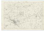
OS1/13/132/1A
| List of names as written | Various modes of spelling | Authorities for spelling | Situation | Description remarks |
|---|---|---|---|---|
| AUCHTERTOOL | Auchtertool Auchtertool Auchtertool Auchtertool Auchtertool |
New Stat. [Statistical] Acct [Account] Old Stat. [Statistical] Acct [Account] Full. [Fullerton's] Gazetteer The Sheriff Co. [County] List of Parishes Johnstone's Co. [County] Map |
035 | [Situation] In the Western division of the Co. [County] of Fife, and on the N. [North] side of the parish of Aberdour. A small parish in the Co. [County] of Fife, bounded on the north by the parish of Auchterderran, on the east by Abbotshall, on the South by Kinghorn and Aberdour, and on the west by the parish of Beath. It is about 3 miles long and averages about 1½ miles in breadth. There is range of hills at the west end, commonly called Cullalo Hills; their aclivity on the south side is very steep, and the elevation of the highest above the level of the sea is 750 feet. The parish throughout is generally well cultivated, in it are two villages namely Newbigging and Auchtertool. The latter containing a population of 350. |
Continued entries/extra info
page 1aNote: Auchter. - Signifying a height. tool seems to be a corruption of the word Tiel, a rivulet. New Stat. [Statistical] Acct. [Account]
Transcribers who have contributed to this page.
GreenflyNZ, Jill S
Location information for this page.
Linked mapsheets.


