OS1/13/131/60


| List of names as written | Various modes of spelling | Authorities for spelling | Situation | Description remarks |
|---|---|---|---|---|
| SHEEPHOUSEWELL | Sheephousewell Sheephousewell Sheephousewell Sheephouse-well Sheephousewell |
And [Adrew] Main Esq (Southfod & Touch) James Glass Robt [Robert] Porteous (Touch) Valn [Valuation] Roll 1848 Road Map |
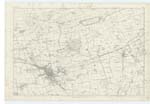
035 | [Situation] ¾ mile SW [South West] of Halbeath. A good farm house and offices the property of R.S. Wellwood Esq Pitliver. There is a small farm att [attached] which the occupier Mr Main Farms, together with his own lands of Tou [Touch]. |
| LYNE BURN | Lyne Burn Lyne Burn Lyne Burn |
Andw [Andrew] Main Esq (Touch) James Stenhouse (Northfod) David Goodall, Hallhouse |
035 | [Situation] Passing the N [North] side of Touch Mill. A middling sized stream formed buy the union of Mowbray a [and] Buckle Burns and running in a Westerly direction by the south si [side] of Dunfermline. Called the Spittel where it is named Spittal or Ly [Lyne] Burn, from here it runs in a SW [South West] direct [direction] to its confluence with the Firth of For [Forth] at Charleston. |
| THE PLOUSEWELL | 035 |
Continued entries/extra info
page 60Trace No.1. Parish of Dunfermline.
Transcriber's notes
This page does not contain details for The Plouse Well.Transcribers who have contributed to this page.
Jill S
Location information for this page.
Linked mapsheets.