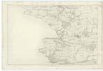
OS1/13/127/5
| List of names as written | Various modes of spelling | Authorities for spelling | Situation | Description remarks |
|---|---|---|---|---|
| CRAIGWELL PATH | Craigwell Path | Mr Christie, Farmer Crombie Mr Tod, Land Steward Tho[ma]s Edgar, Torry Burn |
15 Chains North of Crombie | A portion of the Turnpike Road from Gillanderson Check Bar to Foothies Mill. |
| LONG CRAIG | Long Craig | John Graham John Junior Mr Forrester, Boatman New Mill |
034 | A Low Shelving Whinstone Rock on the S[outh] E[ast] side of Crombie Pier, which is covered at high water. |
| MOUNCHY LOCH | [1] Mounchy Loch, Mounchy Loch, Mounchy Loch, Mounchy Loch; [2] Mulchaloch | Mr J. Watt of Hilton, R. S. Wellwood of Pitliver, Property Map, Map of Turnpike Roads; [2] Johnstons Co. Map | ½ Mile East of Crombie | A small Farmstead occupied by Jas. Lawson Miller, Waulk Mill House. There was formerly a Small Pond on the North Side of the House from which it took the name - Loch. |
Continued entries/extra info
page 5Parish of Torry Burn
[Mounchy Loch] This name may be from the Gaelic Moine . signifying a Mossy place, and Subh . denoting a billberry. Gaelic Dictionary.
Transcribers who have contributed to this page.
Jill S, SimonT
Location information for this page.
Linked mapsheets.


