OS1/13/7/7


| List of names as written | Various modes of spelling | Authorities for spelling | Situation | Description remarks |
|---|---|---|---|---|
| BENARTY HILL | Benarty Hill Benarty Hill Benarty Hill Benarty Hill Benarty Hill Benarty Hill Bennarty Hill Balnarty Hill Benarty Hill Benartie |
Mr. Douglas Maryburgh School Mr. Andrew Greig (Coal Grieve Beath Colliery) Mr. D. Greig Hynde Frazers Co. [County] Map 1841 East Blair Estate Map Mr. Bayley W.S. [Writer to the Signet] (Factor for Lochore) Blairadam Estate Plan Bells Co. [County] Map 1796 Johnston's Co. [County] Map New Stat. Acct. [Statistical Account] |
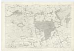
030 | [situation] About 1½ Miles N.E. [North East] of Kelty. A large rocky pasture hill of Considerable elevation extending east and west about three miles along the boundary between Fife and Kinrossshire along the Summit of this hill are Several eminences bearing names and at the Western end of the hill is a bold rocky face chiefly lying in the Parish of Portmoak and known by the name of Mulla Craig. |
| MULLA CRAIG | Mulla Craig Mulla Craig Mulla Craig |
Andrew Douie Esqr. Mr. Douglas (Teacher) Mr. Andrew Greig |
030 | [situation] 1¾ Miles N. [North] of Kelty. A large rocky pasture hill of considerable elevation extending east and west about three miles along the boundary between Fife and Kinross-shire along the summit of this hill are several eminences bearing names and at the western end of the hill is a bold rocky face chiefly lying in the Parish of Portmoak and known by the name of Mulla Craig. |
Continued entries/extra info
page 7Parish of Cleish Trace 2
Note: Mullach - The Top or Ridge of the hill. McAlpines Gaelic Dictionary.
Transcribers who have contributed to this page.
GreenflyNZ, MaxInSpain , Jill S
Location information for this page.
Linked mapsheets.