OS1/13/4/47


| List of names as written | Various modes of spelling | Authorities for spelling | Situation | Description remarks |
|---|---|---|---|---|
| NIVINGSTON CRAIGS | Nivingston Craigs Nivingston Craigs Nivingston Craigs |
Estate Map 1834 Andrew Douie Esq. |
030 | [Situation] 3/4 Mile S.E. [South East] of Cleish. A tolerably long range of precipitous rocks extending East and West along the North Side of Dowhill Muir, about the Centre of them is a small narrow pass well known by the name of Glenwick. |
| GLENWICK | Glenwick Glenwick Glenwick |
John Flockhart David Walls Shepherd Craigencat. George Arnot Cleish Village. |
030 | [Situation] About 3/4 Mile S.E. [South East] of Cleish. A tolerably long range of precipitous rocks extending East and West along the North Side of Dowhill Muir, about the Centre of them is a small narrow pass well known by the name of Glenwick. |
| KIRKHILL COMMON | Kirkhill Common Kirkhill Common |
Estate Map 1824 Andrew Douie Esq. |
030 | [Situation] About 1/2 Mile S. [South] of Cleish. A piece of Moorland lying at the North West Corner of Dowhill Muir and bounded by the Nivingston Road. It was formerly a Common but now it forms part of Blairadam estate. As might be inferred from the above there should be a place in this vicinity called Kirk Hill. If there was such a place formerly as it would appear there was, it is not known nowadays. |
Continued entries/extra info
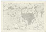
[Page] 47 Plan 30A Trace No.7 Parish of CleishNote: Wick - A word used in the termination of the names of places, signifying a creek or bog. Jameson
Transcribers who have contributed to this page.
Bizzy- Moderator, GreenflyNZ, MaxInSpain
Location information for this page.
Linked mapsheets.