OS1/15/51/7


| List of names as written | Various modes of spelling | Authorities for spelling | Situation | Description remarks |
|---|---|---|---|---|
| FALSIDE WILL | Falside Hill Falside Hill Falside Hill |
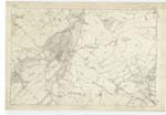
Archibald McKinley, James Smeaton | 013 | [Situation] About 1 mile N.W. by N. [North West by North] from Elphinstone (Tower). A Small arable hill on the farm of Meikle Falside. On its summit is a trigl. [trigonometrical] station called "Fellside". |
| HARRY'S BURN | Harry's Burn Harry's Burn Harry's Burn |
Archibald McKinley James Smeaton Forrest's Map | 013 | [Situation] It forms part of the Bdy. [Boundary] between the Cos [Counties] Haddingn [Haddington] & Edinbu [Edinburugh] and the parishes of - Inveresk & Tranent About ½ Mile from Elphinstone (Tower). A Small stream which rises on the farm of Elphinstone and flows in a South-westerly direction to the farm of Myles where it falls into a Small lake. |
Continued entries/extra info
Parish of Tranent - [Page] 7Form 136
Page 19 Falside Hill
18 Harry's Burn
Transcribers who have contributed to this page.
Chr1smac -Moderator, wilson5bh
Location information for this page.
Linked mapsheets.