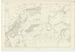
OS1/15/48/48
| List of names as written | Various modes of spelling | Authorities for spelling | Situation | Description remarks |
|---|---|---|---|---|
| HIGHSIDE | Highside | Mr William Brown, Halls Mr John Dods, Pathhead Map of Halls farm |
011 | A small hill partly Covered with Furze sloping down to the Black And dry Lochs on the farm of Halls, of which Mrs H N Ferguson of Beil is proprietrix and Mr William Brown occupier. |
| THE SNEEP | The Sneep | Mr William Brown, Halls Mr John Dods, Pathhead Map of Halls farm |
011 | A precipitous brow along the Eastern side of Brock Burn covered with furze, on the farm of Halls - |
| BROCK BURN | Brock Burn | Mr William Brown, Halls Mr John Dods, Pathhead Map of Halls farm |
011 | A small stream which takes this Name from the junction of the How and Halls Burns, when passes in a Northern direction through the Halls farm until it falls into Spott Burn below Burnhead Smithy, before the adjacent land was Cultivated, its banks were a Celebrated Cover for Badgers |
Continued entries/extra info
[Page] 48Parish of Spott
Plan 11 D Trace No 2
[Signed] James McAnulty
Transcribers who have contributed to this page.
DANIALSAN, JCB
Location information for this page.
Linked mapsheets.


