OS1/15/48/21


| List of names as written | Various modes of spelling | Authorities for spelling | Situation | Description remarks |
|---|---|---|---|---|
| HILLDOWN (Ruins of) | Hilldown (Ruins of) Hilldown (Ruins of) Hilldown (Ruins of) Hilldown |
W. Brown John Wood Map of Farm Forrest's Co [County] map |
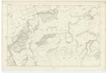
011 | [Situation] About 1 1/4 mile E by N [East by North] from Halls. The ruins of a farm house and offices which formerly had a farm attached but is now joined with that of Halls. |
| TINKER'S LEAP | Tinker's Leap Tinker's Leap Tinker's Leap Tinker's Loup |
William Brown John Wood Map of Farm Forrest's Co [County] Map |
011 | [Situation] About 1 1/8 Mile E [East] from Halls. A high bank or precipice on the Woodhall Burn, over which it is said that a Tinker leaped, hence the name. |
| SPRUCE CLEUGH | Spruce Cleugh Spruce Cleugh Spruce Cleugh |
William Brown John Wood Map of Farm |
011 | [Situation] About 1 1/2 mile E by N [East by North] from Halls. A small glen or ravine through which runs a small stream. It is situated on the north side of Woodhall Burn. |
Continued entries/extra info
[Page] 20No 3
Parish of Spott
Form 136 Page
53 Hilldown (Ruins of)
53 Tinker's Leap
53 Spruce Cleugh
Transcribers who have contributed to this page.
DANIALSAN, JCB
Location information for this page.
Linked mapsheets.