OS1/15/46/9


| List of names as written | Various modes of spelling | Authorities for spelling | Situation | Description remarks |
|---|---|---|---|---|
| SPOTT [parish] | Ph [Parish] of Spott Ph [Parish] of Spott Ph [Parish] of Spott Ph [Parish] of Spot |
Full. [Fullarton's] Gazetteer Stat Acct [Statistical Account] 1841 Johnstons Co. [County] Map Co [County] Map 1799 |
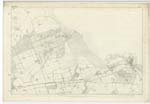
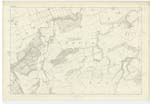
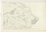
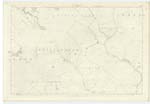
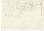
006 ; 011 ; 012 ; 016 ; 020 | [Situation] In the Eastern portion of the Co. [County]. A parish in Haddingtonshire consisting of two detached districts. The larger & which is, in this instance the Parish and more valuable district is bounded on the North west and North by Dunbar, on the East by Dunbar and Innerwick, on the South by Dunbar Common, and on the West by Stenton. Its area is about 2,880 acres. The smaller district lies 2 1/2 miles south of the nearest point of the other, consists of a stripe 2 3/4 miles in length and 3/4 mile in mean breadth, and is bounded on the North by Dunbar Common, on the East by Innerwick, on the South by Whiteadder Water which divides it from Berwickshire, and on the west by the largest detached portion of Stenton. It is in the Presbytery of Dunbar and Synod of Lothian and Tweeddale. Patron Sprott of Spott |
Continued entries/extra info
[Page] 9Parish of Spott
Wherever the Parish Church is Situated,
that is the parish - all other portions of
the parish are "Detached" however
large they may be.
O.M.O. [Ordnance Mapping Office]
Transcribers who have contributed to this page.
DANIALSAN, JCB
Location information for this page.
Linked mapsheets.