OS1/15/46/21


| List of names as written | Various modes of spelling | Authorities for spelling | Situation | Description remarks |
|---|---|---|---|---|
| SPOTT DOD | Spott Dod Spott Dod Chesters Chesters |
John Wood Robert Howliston Co. [County] Map (1799) Johnston's Co. [County] Map |
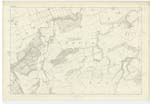
011 | [Situation] About 3/4 Mile E.S.E. [East South East] from Little Spott. A middling sized hill on the farm of Spott, its surface is arable land. On its summit is a Trig. [Trigonometrical] Station called by Trig. [Trigonometrical] Party "Chesters". This hill is not known in the locality by the name Chesters. |
| THE CHESTERS (British Fort) | The Chesters The Chesters |
John Wood Robert Howliston |
011 | [Situation] About 5/8th Mile S.S.E. [South South East] from Little Spott. The remains of an ancient camp Situated upon an eminence a little S.W. [South West] of the village of Spott. The trenches though Cultivated are Still visible It is supposed to be (by the people of the locality) of Saxon or Danish origin "Besides the remains of General Leslie's Camp on Doonhill, there are still visible the remains of another Camp on a hill to the S.W. [South West] of the village, supposed to be of Roman or perhaps Danish origin. Part of an ancient Spear was lately found near this Camp, and is now in possession of the proprietor of Spott" see Stat Acct. [Statistical Account] |
Continued entries/extra info
[Page] 21Parish of Spott
Form 136 Page
40 Spott Dod
39 The Chesters (British Fort)
[Note] Not found on plan O.M.O. [Ordnance Mapping Office]
On West Side of
Examination trace 4
Transcribers who have contributed to this page.
DANIALSAN, JCB
Location information for this page.
Linked mapsheets.