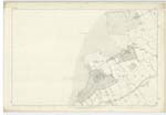
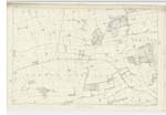
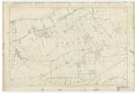
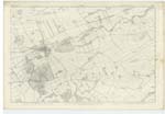
OS1/15/40/37
| List of names as written | Various modes of spelling | Authorities for spelling | Situation | Description remarks |
|---|---|---|---|---|
| HADDINGTON [parish] | Parish of Haddington Parish of Haddington Parish of Haddington Parish of Haddington Parish of Haddington |
Co. [County] Map (1799) Stat Acct [Statistical Account] (1841) Full. [Fullerton's] Gazetteer Co. [County] Map Johnstons List of Farms Co. [County] Haddington |
004 ; 005 ; 009 ; 010 | A large parish nearly in the centre of Haddingtonshire, bounded on the North by Aberlady and Atholstaneford on the east by Prestonkirk on the S. [South] east by Morham, on the South by Yester, Bolton. Salton and Gladsmuir and on the West by Gladsmuir and Atholstaneford. the parish is about 6 miles length. 6 in breadth and contains about 22 1/2 Square Miles or about 12000 Scotch acres, and is all throughout well cultivated and diversified with enclosed fields, ParKs, and plantations &c. It contains the Co. [County] town of Haddingtonshire, for which see description in an adjoining Name book, Haddington is the Seat of a Presbytery in the Synod of Lothian & Tweeddale, Patron the Earl of Hopetoun, There are no detached portions of this parish nor are there any detached portions of any other parish within Haddington parish. |
Continued entries/extra info
[Page] 37[Note]
There is a Detached portion of the Parish
of Athelstaneford Situated on the N. E. [North-East]
boundary of the Parish of Haddington
this Detached portion will be found
on plan 10.B. and at the West margin
of that plan
O.M.O. [Ordnance Mapping Office] 17th Novr. [November] 1853
(See remarks on plan 10.A.)
Transcribers who have contributed to this page.
Bizzy- Moderator, Douglas Montgomery
Location information for this page.


